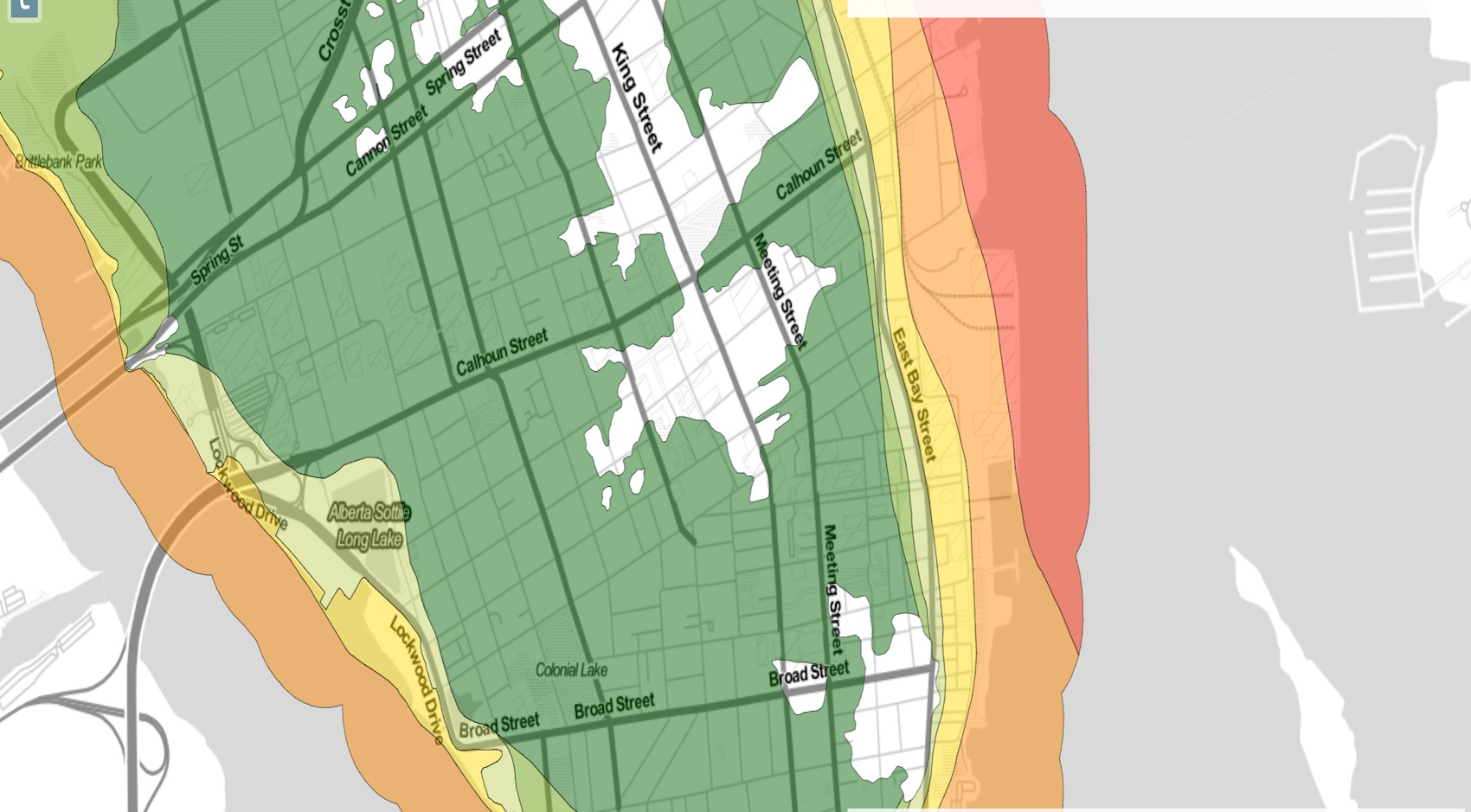
 Yesterday we heard about the effect of sea level rise from Historic Charleston Foundation in their Spring Lecture Series. In today’s issue of The New York Times, Charleston was mentioned in an article about sea levels rising at the fastest rate in 28 centuries. Part of our ongoing mission is to help educate current residents as well as prospective buyers in Charleston’s rapidly growing real estate market, as to how the flood issues and current flood zones affect them. So we have created a map to help you understand what it means and to identify those properties at the highest and least risk of flooding. Here is how you find it.
We all have access to the internet these days. Go to www.thecharlestonmap.com. This map is the result of a long and coordinated effort of data collection, combining geographical reference data for location (GIS) with historical data on your home. We add in height data and sea level data to produce a single map image that provides accurate insight into current flood risks and future flood risk. It is indeed telling but not as unmanageable as some would make out. With a 6 foot rise in sea level the map of Charleston looks identical to the original map of Charleston in 1680. Marsh and sea shores are back in their original position. Yes, that data is reflected in the map too.
So here is a useful head start to get you going:
- How to use the map: http://luxurysimplified.com/charleston-map/how-to-use.cfm
- FEMA flood zone data :http://luxurysimplified.com/charleston-map/#0
- Sea level rise above mean highest high water :http://luxurysimplified.com/charleston-map/#0
- Historic map of 1680 : http://luxurysimplified.com/charleston-map/#0
You will get the best out of this map by playing with the various options for a while and overlaying data. Some data layers can be made increasingly transparent so that you can see data underneath. The data reference sources are accurate and the best available, this is real data and not a slick marketing play. We have taken data from NOAA Coastal Partnership and from FEMA Flood Zones, from City of Charleston, Charleston County, Federal Government, College of Charleston……
Have fun and, if you get confused or have any questions at all then, just give us a call.
Tips – Avoid buying homes on old creek bed and low lying marsh infill (the sea level rise map clearly shows those areas). You can protect yourself by lifting a home during a current or planned renovation (we can help you do that!). New homes in the Charleston area are now built at a height resistant to flooding but your parked vehicle is not. Try to find properties in “X ” Zones or at a good elevation in “AE ” Zones.
Read the complete New York Times article here: “Seas Are Rising at Fastest Rate in Last 28 Centuries “
Interested in Learning More?
Our expert teams - from development, investment, real estate, and property management - have experienced it all and have the insight to help you along the way.
Find Out More